Description
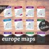
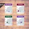
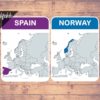
Teach the map of Europe Continent (53 Countries + 1 Other Territories) using these Europe Map Flash Cards / Three-Part Cards.
This Montessori activity to learn the maps of countries in Europe can improve learning ability of the kids to a great extent.
Includes:
54 different flash cards/three-part cards for the following European countries and other territories:
- Albania
- Andorra
- Armenia
- Austria
- Azerbaijan
- Belarus
- Belgium
- Bosnia and Herzegovina
- Bulgaria
- Croatia
- Cyprus
- Czech Republic
- Denmark
- England
- Estonia
- Finland
- France
- Georgia
- Germany
- Great Britain
- Greece
- Hungary
- Iceland
- Ireland
- Italy
- Latvia
- Liechtenstein
- Lithuania
- Luxembourg
- North Macedonia
- Malta
- Moldova
- Monaco
- Montenegro
- Netherlands
- Northern Ireland
- Norway
- Poland
- Portugal
- Romania
- Russia
- San Marino
- Scotland
- Serbia
- Slovakia
- Slovenia
- Spain
- Sweden
- Switzerland
- Turkey
- Ukraine
- Vatican City
- Wales
Other Territories/Overseas Territories:
- Kosovo
Features:
1. Digital Download
- 1 Instant downloadable PDF File (15 pages of size 8.5in x 11in).
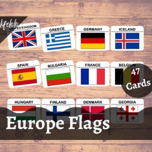
- Includes 54 Flashcards (4 flash cards per page)
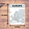
- Includes 1 Full Page Europe Map with name of countries.
- Just PRINT, LAMINATE (Optional) and CUT!
2. Laminated Flash Cards
- Includes 54 Flash Cards + 1 Full Page Europe Map.
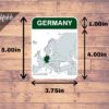
- Each flashcard measures approx. 5.00in x 3.75in.
- The printed & laminated flashcards will be shipped within 2 days.
3. Laminated Three Part Cards
- Includes 54 Flash Cards / Control Cards + 54 Label cards + 54 Picture Cards /Image Cards + 1 Full Page Europe Map.
- Each control card measures approx. 5.00in x 3.75in, label card measures 1.00in x 3.75in & image card measures 4.00in x 3.75in.
- The printed & laminated cards will be shipped within 2 days.



ksenia (verified owner) –
convenient. Download right away