Description
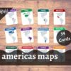
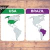
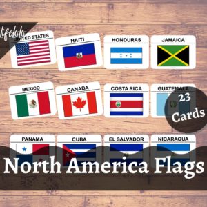
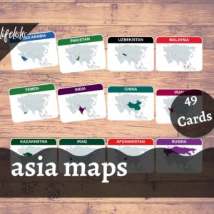
Teach the map of North America & South America Continents (35 Countries + 14 Other Territories) using these Americas map Flash Cards / Three-Part Cards.
This Montessori activity to learn the maps of countries in Americas can improve learning ability of the kids to a great extent.
Includes:
49 different flash cards / 3 part cards for the following North & South American countries and other territories:
- Antigua and Barbuda
- Bahamas
- Barbados
- Belize
- Canada
- Costa Rica
- Cuba
- Dominica
- Dominican Republic
- El Salvador
- Grenada
- Guatemala
- Haiti
- Honduras
- Jamaica
- Mexico
- Nicaragua
- Panama
- Saint Kitts and Nevis
- Saint Lucia
- Saint Vincent and the Grenadines
- Trinidad and Tobago
- United States
- Argentina
- Bolivia
- Brazil
- Chile
- Colombia
- Ecuador
- Guyana
- Paraguay
- Peru
- Suriname
- Uruguay
- Venezuela
Other Territories/Overseas Territories:
- Aruba
- Bermuda
- British Virgin Islands
- Cayman Islands
- Curacao
- French Guiana
- Falkland Islands
- Guadeloupe
- Martinique
- Montserrat
- Puerto Rico
- Saint Pierre Et Miquelon
- Turks & Caicos Islands
- Virgin Islands
Features:
1. Digital Download
- 1 Instant downloadable PDF File (14 pages of size 8.5in x 11in).
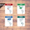
- Includes 49 Flashcards (4 flash cards per page)
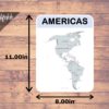
- Includes 1 Full Page Americas Map with name of countries.
- Just PRINT, LAMINATE (Optional) and CUT!
2. Laminated Flash Cards
- Includes 49 Flash Cards + 1 Full Page Americas Map.
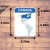
- Each flashcard measures approx. 5.00in x 3.75in.
- The printed & laminated flashcards will be shipped within 2 days.
3. Laminated Three Part Cards
- Includes 49 Flash Cards / Control Cards + 49 Label cards + 49 Picture Cards /Image Cards + 1 Full Page Americas Map.
- Each control card measures approx. 5.00in x 3.75in, label card measures 1.00in x 3.75in & image card measures 4.00in x 3.75in.
- The printed & laminated cards will be shipped within 2 days.



Reviews
There are no reviews yet